At the detection level, basic research required to efficiently produce and process (high quality and high resolution) original data is conducted. The main aim of our work at the detection level is to provide evidence (features) and input data for modelling landscapes over the long term. Remote sensing – airborne and satellite, optical, radar, and lidar – is being used and complemented with advanced data processing.
Satellite images and aerial photography
In the field of optical image processing, we will continue the work by the members of the group in several areas in France, Slovenia, Mexico, and Croatia. Medium (Landsat, SPOT) and high resolution (QuickBird and IKONOS) satellite images will be processed to expose features related to archaeological remains and paleorelief (Oštir et al. 1999, Nuninger and Oštir 2005, Oštir and Nuninger 2006). Information about anomalies manifested as local changes in the health or overall state of the vegetation for example, can be obtained by computing standard indices (NDVI, IR/R, etc.) from multispectral data (Kvamme 2005, Rothaus and De Morett 2001, Saturno et al. 2006). The proposed methodology will use multi-temporal datasets, to account for changes during the growth season and the seasonal humidity changes (floods, droughts). Spectrally rich data from medium resolution satellites (e.g. Landsat) will be supplemented with information from high resolution satellites (Švab and Oštir 2006). Optical data will be combined with radar images to detect humidity changes and to produce digital elevation data. Interferometric processing will be applied in different areas with different parameters (Holcomb 1998, Lira et al. 2005).
Building on our combined research experience, the work carried out in this programme will enable the detection and characterization of features of interest in great detail. Satellite images will be complemented with aerial photography, especially archival photographs to provide the basis for the photo interpretation of both recent and past landscapes (historical photo analysis) (Kvamme 2005).
Lidar
One of the most important remote sensing data sources for used at the detection level will be lidar. Lidar (light detection and ranging) technology is similar to radar, in that it measures the time delay between transmission of a pulse and detection of the reflected signal. to establish the spatial position of a target. Lidar scanners used to survey the earth's surface use lasers which emit short near infrared pulses, which are returned both from vegetation and the ground (ultraviolet and visible light lasers are used in other applications such as aerosol, atmospheric and bathymetric survey). This enables the production of very accurate digital elevation models and vegetation maps (Kvamme 2005, Kobler et al. 2006). The laboratory is developing processing methods for the application of lidar in archaeology and geomorphology. The Slovenian team is active  in the development of lidar point cloud filtering algorithms for the production of better DEMs and to obtain vegetation parameters, i.e. canopy profiles etc. (Kobler et al. 2006). River channels, terraces building footprints and other features of interest can be observed under forest canopy after filtering. Current research in the detection level focuses on on identifying and mapping geomorphological features such as palaeochannels, river terraces, and floodplains in order to identify areas of potential for preservation and erosion and variations in micro-topography likely to indicate favourable locations for past activities or archaeologically significant remains and landscape features.
Terrain modelling
Lidar will be only one of the sources of elevation data 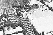 (digital elevation model, DEM). Members of the group have developed a methodology that uses best properties of all existing datasets, e.g. different raster DEMs, contour lines, hydrology, land cadastre, geodetic point, etc., and integrates them into model that is overall better than individual datasets. A weighted sum with geomorphological corrections can be used to obtain a visually and morphologically homogenous model. While lidar can be used in local or micro-local scale, advanced interpolation will be applied in regional or supra-regional scale (Podobnikar 2005). The DEM will be further processed to compute derivatives, such as slope, aspect, curvature, roughness, texture, and solar illumination (Brossard and Joly 1996, Brossard et al. 2002, Zakšek et al. 2005).
Data enhancement and integration
Image processing techniques will be developed to support the detection of structures and features. Initially, basic methods like edge enhancement and detection filters will be used, and later the object recognition will be incorporated (Nuninger and Oštir 2005, Oštir et al. 2006).  This simple filtering enhances the visual interpretation and detection of paleo features and remains of human activities. Automatic feature extraction techniques in digital remote sensing usually rely on the varying spectral properties of ground surface materials (i.e. the parts of the electromagnetic spectrum that they absorb and reflect to a varying degree). Lidar imagery provides only variations in elevation (and the more problematic intensity data) as a means of identifying features. Automatic feature identification with such data requires the recognition of patterns in a single variable; for example, algorithms can be used to locate the edges of discrete features through rapid changes in elevation, or to identify areas of contiguous higher or lower elevation. A variety of techniques, like subtraction of interpolated data from surface model, can be employed to achieve this and to extract features of interest (Fowler 2002; Hesse 2010).
While basic image processing and enhancement can be used to improve feature identification, object oriented approaches are seen as having more potential for the consistent, accurate and efficient identification of features in remotely sensed data. High resolution optical data (imagery with the resolution in the order of 1 m) obtained from aircraft and satellite allows the detailed definition of the morphological and spectral characteristics of objects that represent real features of interest like rivers, paleochannels, terraces or roads. Similarly, DEMs produced from lidar show detailed elevation changes enabling the detection of objects based on their morphological characteristics. The combination of high resolution multispectral and lidar data may further improve feature detection through object-oriented methods.
The laboratory will develop methods to integrate different datasets and include them in common analyses. We will include multi sensor, multi temporal, and multi resolution data. Various techniques will be developed and tested with specific datasets in specific geographical conditions.