The LEA ModeLTER (European Laboratory for Modelling of Landscapes and Territories over the Long Term) is a collaborative
Franco-Slovenian team which aims to conduct research which will develop concepts and methods for the study of long-term socio-environmental relationships. Through various applications and research projects, the team studies territorial strategies and their links with systems of landscape production. The laboratory has a dual purpose: to model possible explanations of changes and to understand phenomena linked to stability, in order to provide useful indicators for sustainable development studies.
ModeLTER’s scientific programme consists of three areas, or levels, of research activity corresponding to the three stages of our research process:
-
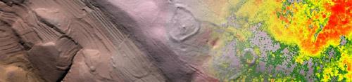
Detection is the basic level of research required to produce and process original data of high quality and resolution, such as archaeological and land-use maps, or digital elevation and terrain models (DEM/DTM) for analysis and interpretation.
-
Contexts is the analytical research level, where original datasets are combined to create indicators of changes, rhythms, perceptions and decisions related to settlement patterns, physical landscape development, mobility, and territorial control.
-
Prediction is the level where all previous results are integrated to produce general models and to confirm indicators, as defined within the framework of activity 2.
In addition, the laboratory is developing a programme for Tools and databases in order to integrate the results of the group's efforts into the framework of different cooperative platforms, such as Archaeores, Arkas, ZRCGIS and CAENTI. This work programme aims to build, diffuse and transfer tools and databases produced by ModeLTER.
These research activities will be carried out through several case studies in different European and overseas areas (Albania, Croatia, France, Hungary, Italy, Mexico, Romania, and Slovenia).
We believe that ModeLTER will become an incubator for ideas and methods, an important collaborative group involving researchers from many different disciplines, producing results of broad interest.
Main activities and fields of research:
-
Detection
-
Satellite images and aerial photography
-
Lidar
-
Terrain modelling
-
Data integration
-
Contexts
-
Land use and practices of spaces over time
-
Territorial strategies
-
Prediction
-
Prediction with explicative methods
-
Prediction with geostatistical methods
-
Tools and databases